|
Size: 1183
Comment:
|
← Revision 19 as of 2010-06-05 18:38:23 ⇥
Size: 2461
Comment:
|
| Deletions are marked like this. | Additions are marked like this. |
| Line 7: | Line 7: |
* [[http://www.openstreetmap.org/?minlon=12.0041132655&minlat=41.9326959735&maxlon=12.3241132655&maxlat=42.2526959735 | OSMap]]. * [[http://maps.google.com/maps?f=q&source=s_q&hl=en&geocode=&q=Bracciano+RM,+Italy&sll=37.0625,-95.677068&sspn=36.042042,35.595703&ie=UTF8&hq=&hnear=Bracciano+Rome,+Lazio,+Italy&t=h&ll=42.106079,12.188033&spn=0.002062,0.002173&z=18 | gmaps aerial view]] |
|
| Line 12: | Line 16: |
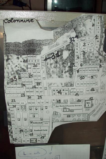
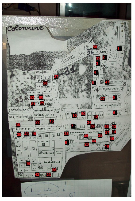
| * Hand Made Topological Map (in red the last IP digit of the 45 deployed nodes over the camp) [[attachment:hand-made-topological-map.jpg|{{attachment:powermap2thumb.jpg}}]] * Text file with description of the location of the node over the camp [[attachment:map-sorted2.txt]] |
|
| Line 14: | Line 21: |
FREE PLUGS ("-" means free but not working) ||col. n. || free plugs || ||1||1, 3|| ||2||2|| ||3|| NOT EXISTS|| ||4||3|| ||5||1 (dirty)|| ||6||-2|| ||7||1,2|| ||8|| NO FREE PLUGS|| ||9|| 1|| ||10||3,-5,-6|| ||11||1,2|| ||12||-1|| ||13||1,3|| ||14||-2|| ||15||4|| ||16||2,3|| ||17||2,-3|| ||18||1,2,-3|| ||19||1,2,-3|| ||20|| NOT EXISTS || ||21||1,2,3|| ||22||1,2,3|| ||23||2,3|| ||24||1,2,3|| ||25||1,2,3|| ||26||5,6,7|| ||27||1,3|| ||28||1,2,3|| ||29||UPPER PLUGS FULL, 5, -6|| ||30||1,2|| ||31 (32 on the map)|| NO FREE PLUGS|| ||32 (31 on the map)||2|| ||33||-1,-2|| |
Map
This page is dedicated to the site map of the camping for the WBMv3
Contents
Map
- Hand Made Topological Map (in red the last IP digit of the 45 deployed nodes over the camp)
Text file with description of the location of the node over the camp map-sorted2.txt
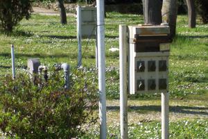
FREE PLUGS ("-" means free but not working)
col. n. |
free plugs |
1 |
1, 3 |
2 |
2 |
3 |
NOT EXISTS |
4 |
3 |
5 |
1 (dirty) |
6 |
-2 |
7 |
1,2 |
8 |
NO FREE PLUGS |
9 |
1 |
10 |
3,-5,-6 |
11 |
1,2 |
12 |
-1 |
13 |
1,3 |
14 |
-2 |
15 |
4 |
16 |
2,3 |
17 |
2,-3 |
18 |
1,2,-3 |
19 |
1,2,-3 |
20 |
NOT EXISTS |
21 |
1,2,3 |
22 |
1,2,3 |
23 |
2,3 |
24 |
1,2,3 |
25 |
1,2,3 |
26 |
5,6,7 |
27 |
1,3 |
28 |
1,2,3 |
29 |
UPPER PLUGS FULL, 5, -6 |
30 |
1,2 |
31 (32 on the map) |
NO FREE PLUGS |
32 (31 on the map) |
2 |
33 |
-1,-2 |
JPG
GPX data
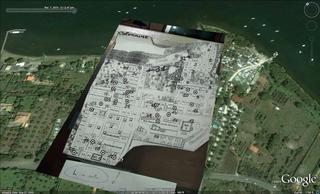
GPS data matched with the map in the picture: PowerPlugs.gpx
Original GPS data: Trk_10-03-07_13-13-17.xml

